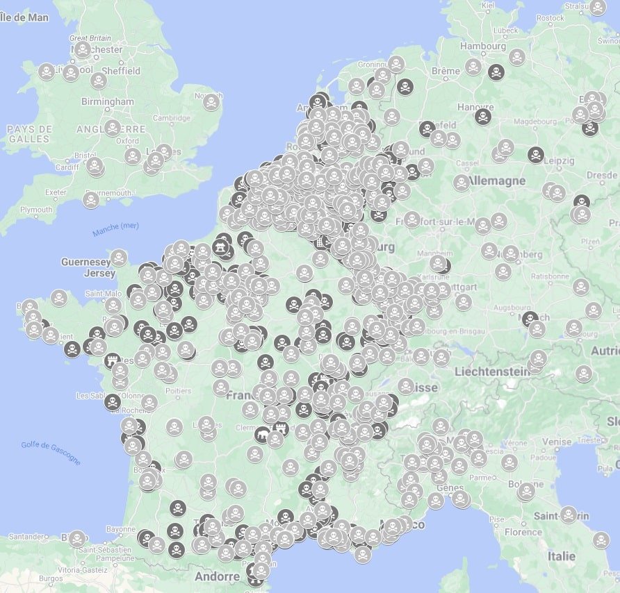


What is this dead spots map?
It's simple, it's urbex spots that are outdated (renovated, burnt down, new owner, demolished, emptied...).
Here we give you access to our work updating urbex spots in our database. But why do it?
Some explorers have their own maps with spots that are getting old and don't know if they're still up to date. This map can help them to sort things out.
Option 1 : Simply view the map on our website
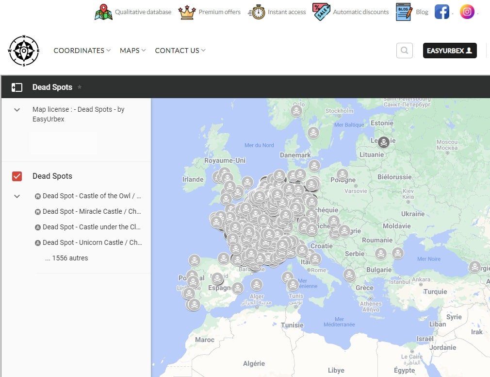
The map opens on our website. A web page will open in which the map has been integrated.
This is the map we use every day to identify dead spots. It is therefore updated very regularly with the addition of new dead spots.
No need to purchase upgrade for this one. Once you have access, it is for life, with regular updates.
You can consult your maps on any device (computer, tablet, mobile...)
The map was made on Google My Maps.
All is automated, so no human-action is required to provide the map to you. This means that access is immediate: once the map has been paid for, you have access automatically.
If you are unable to access your map, see how to access my map or contact us, we will help you.
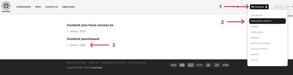
1 - LOGIN
In the top right-hand corner, select "LogIn" and enter your username and password. Identifiers you entered at the time of purchase.
2 - PURCHASED CONTENT
Select "Purchased Content" or "Orders".
3 - YOUR MAP IS HERE
Select your map under "Content purchased" or under "Access your purchased content" if you choose "Order".
Option 2 : KMZ and KML files + view the map on our website
You obviously have access to the map on our website as explained in option 1 above.
In addition to this, we will send you the KML and KMZ file of the dead spots map within 72 hours to the email address you provided at the time of purchase.
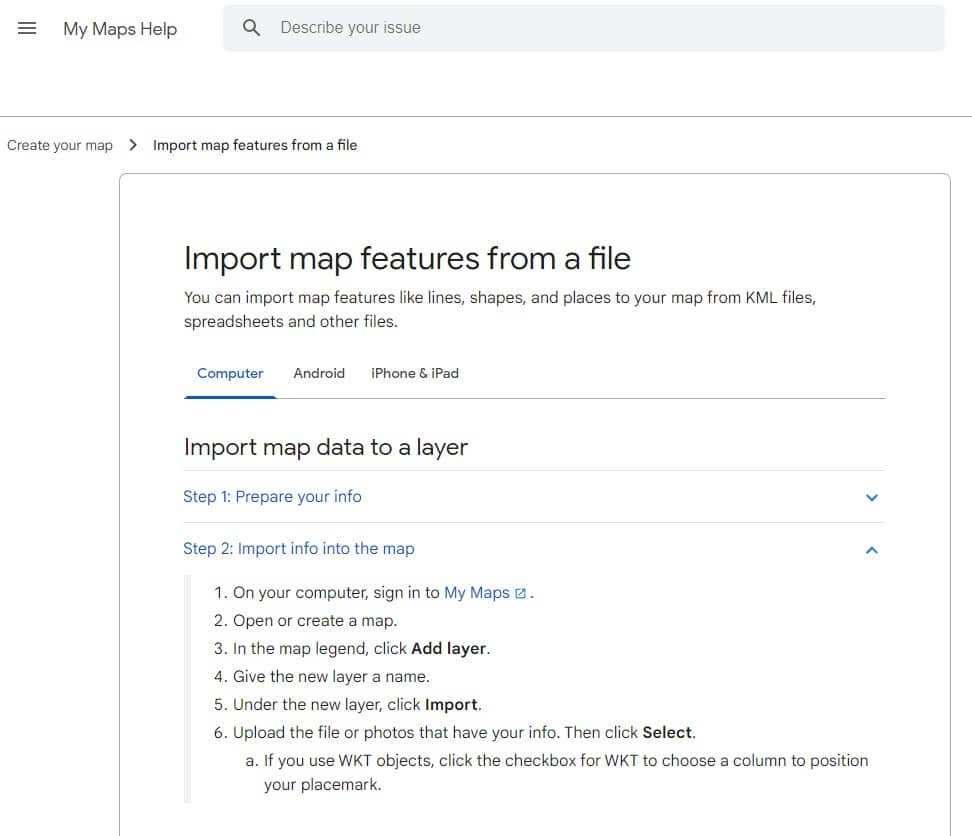
Why do you need KML / KMZ files?
Very useful if you've created your maps on Google My Maps, Umap or others mapping apps. You can import the KML or KMZ file directly onto your mapping app and the dead spots will be added directly to your map, making sorting much quicker and easier.
Definition : KML and KMZ are both file formats that are used to display geographic data in Google Earth and other mapping apps. KML is an XML-based file format for storing three-dimensional geographic data, whereas KMZ is a compressed file format that contains one or more KML files as well as their associated resources.
Reviews
There are no reviews yet.